Abandoned Houses in Ulnes Walton
near Leyland in Lancashire -
Low House
Strictly speaking, I suppose the word in the title should be 'Buildings' as opposed to 'Houses', however, the main place of interest is 'Low House'. From a historical point of view, that location seems to have been in existence for an number of centuries. At this stage, it seems unlikely that the abandoned buildings represent the original property. Web searches are not revealing any great detail at this point.
The journey starts when I began watching urban and historical exploration videos on YouTube. In the past, I had always been interested in exploring, and finding out more information about the places I had visited. Watching the videos opened up a number of opportunities to find out about new places. On this occasion, it was more about the tools and methods of finding 'stuff', as opposed to somebody suggesting a location on a video.
I had learned about some old maps hosted online, from a number of the YouTubers. The ones of particular interest to me where the early Ordnance Survey maps that currently hosted by the National Libraries of Scotland. More specifically, the have an excellent tool that allows you to look for old places by placing two maps side by side on one webpage. This allows you to compare georeferenced historic maps in a split-screen viewer side-by-side with other map layers. I tend to use the satellite image view for making comparisons. This is a relatively up-to-date satellite image, that is comparable to the one that can be seen on Google Maps. By way of example, I have put a link below to the NLoS 'Side by Side' viewer for the location I am investigating on this post. It is centred on 'Low Moss House' and shows it on an Ordnance Survey Six-inch scale map that was surveyed during the years 1844 to 1846 and subsequently published in 1848. Its reference is 'Lancashire Sheet LXIX'.
Armed with this virtual exploring tool, I was having a look at new places to explore nearby that were on the route between home and my Mum's place, on the way to Southport. I panned around the countryside to to the west of Leyland, and started noticing some interesting building footprints on the satellite view. The satellite image at the time, didn't have enough detail to explore exactly what was there, but it was obvious that something was. I consigned the information to the memory banks, and thought to myself, "next time (...or one time) it is decent weather, I will have a walk around there. I possibly do that before or after visiting my Mum.
The Explore
As it transpired, the opportunity arose at the beginning of May 2023. Specifically, it was Monday the 1st of May, and that was the Early May Bank Holiday in England. It was a very nice day, but I left it until the early evening in the hope that the Lanes near to the location would be quieter. It wasn't something that I had been considering doing all weekend, and wasn't fully prepared for it. I think my camera batteries were flat, so I just head off with the smartphone, which takes reasonable photographs. They're just not as good as the Nikon Digital Bridge Camera I normally have at my disposal.I often consider walking that far, and back, but it was more logical to to drive on this occasion, as per the earlier comments, that would offer an opportunity the do some visiting afterwards. It would have been at least a 12 mile round trip to make the journey on foot. I can't remember where I parked (I might come back to that, as I normally record a GPS track whilst I am out walking or cycling). However, I do remember that I accessed the location from Nixon Lane, which is off School Lane near Moss Side, Leyland. The Postcode is PR26 8LY.
Following Nixon Lane in a westerly direction, the lane eventually turns into an 'unmade' road and it is effectively now used as a bridleway and farm track. The place of interest is just before a ninety degree bend, or junction, that take you onto Nell Wareing Lane. I am not sure if that was a person's name, I may come back to that point. As you travel westwards on Nixon Lane, the buildings are on your right. The first building did not appear to be accessible without climbing over closed gates or fences, so I carried on looking for an obvious entrance. As is usually the way with these things, the next entrance had been once gated off, but had been neglected and people had previously found a way in. I just followed in their footsteps.
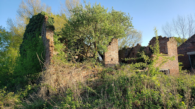
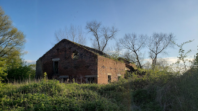
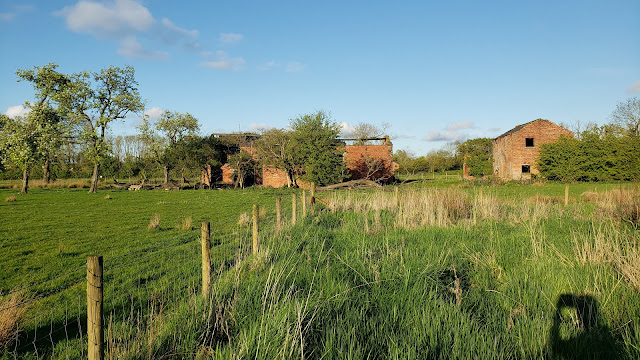
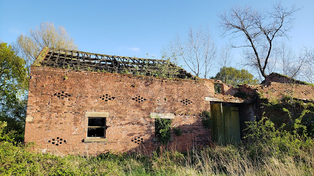
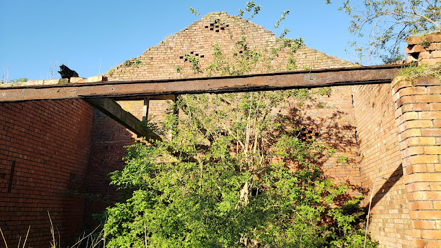
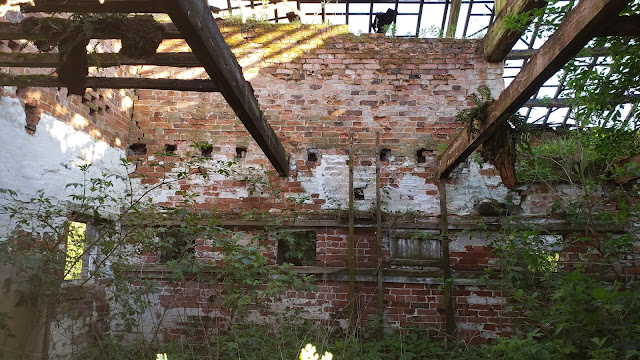
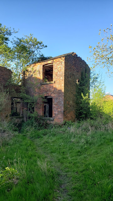
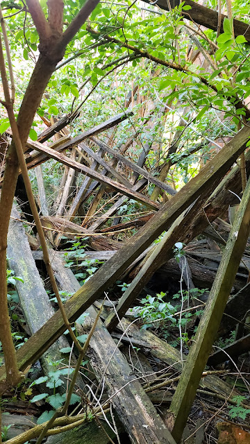
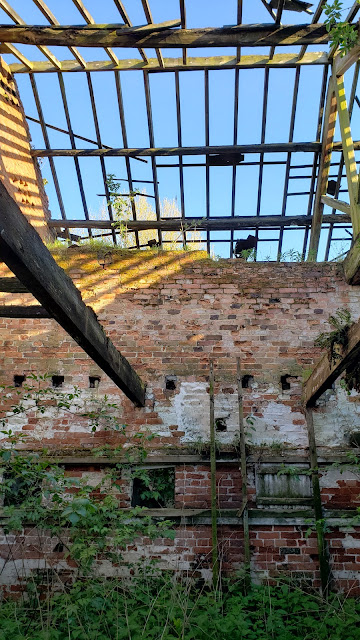
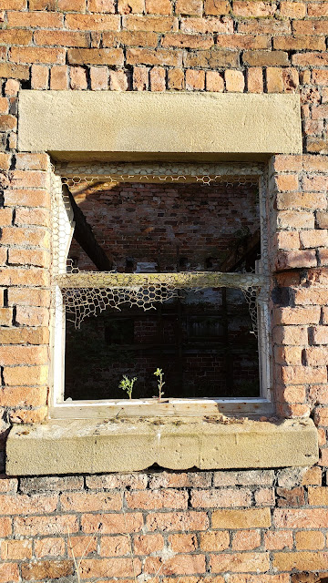
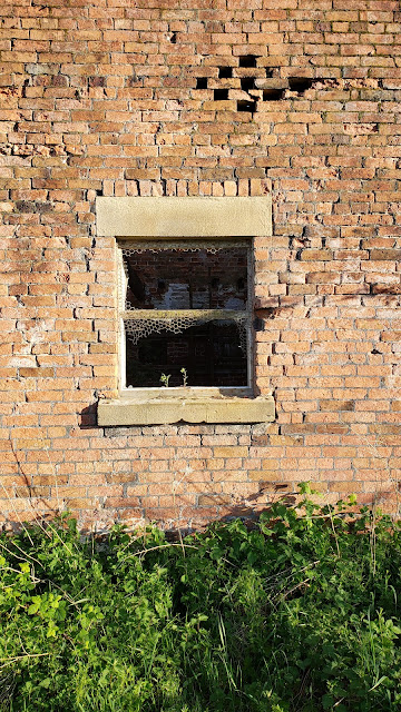
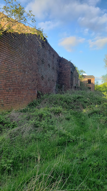
It is possible to see things from the lane, but I thought I would get a much better look by going inside. The next set of photographs are the what I took on my Smartphone whilst having a decent explore.
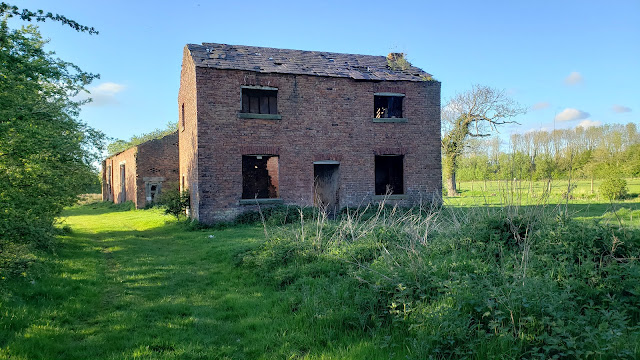 |
| Abandoned Property Low Moss House |
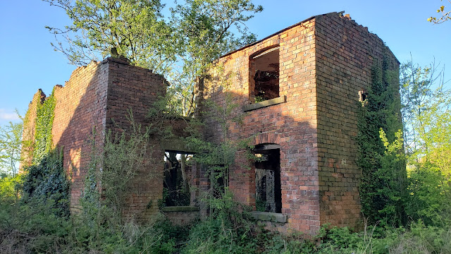 |
| Abandoned Property Low Moss House |
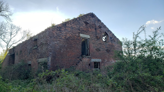 |
| Abandoned Property Low Moss House |
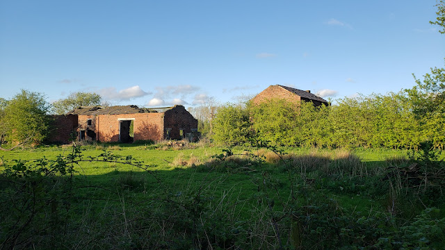 |
| Abandoned Buildings Around the Property Low Moss House |
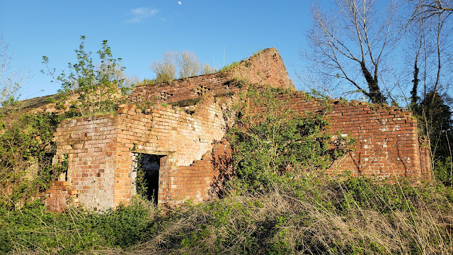 |
| Abandoned Buildings Around the Property Low Moss House |
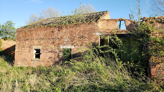 |
| Abandoned Buildings Around the Property Low Moss House |
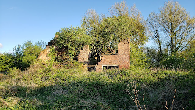 |
| Abandoned Buildings Around the Property Low Moss House |
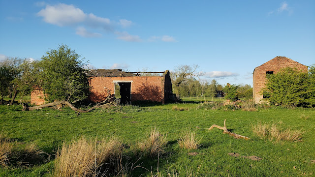 |
| Abandoned Buildings Around the Property Low Moss House |
 |
| Abandoned Buildings Around the Property Low Moss House |
 |
| Abandoned Buildings Around the Property Low Moss House |
 |
| Abandoned Buildings Around the Property Low Moss House |
 |
| Abandoned Buildings Around the Property Low Moss House |
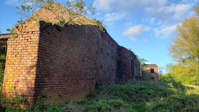 |
| Abandoned Buildings Around the Property Low Moss House |
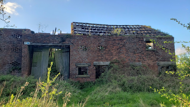 |
| Abandoned Buildings Around the Property Low Moss House |
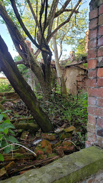 |
| Inside the Abandoned Buildings Around the Property Low Moss House |
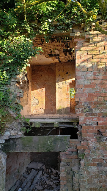 |
| Inside the Abandoned Buildings Around the Property Low Moss House |
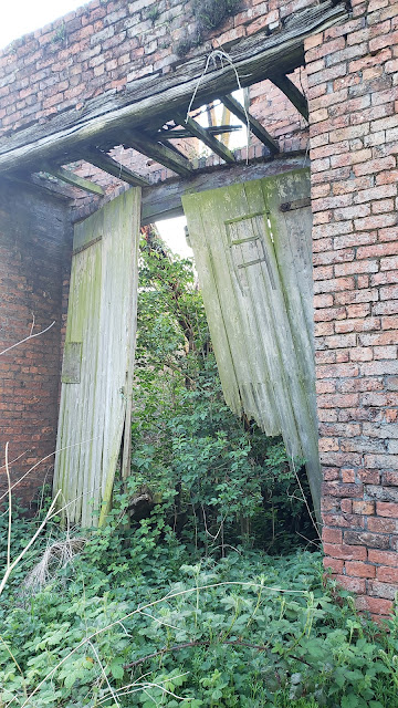 |
| Barn Doors at the Property Low Moss House |
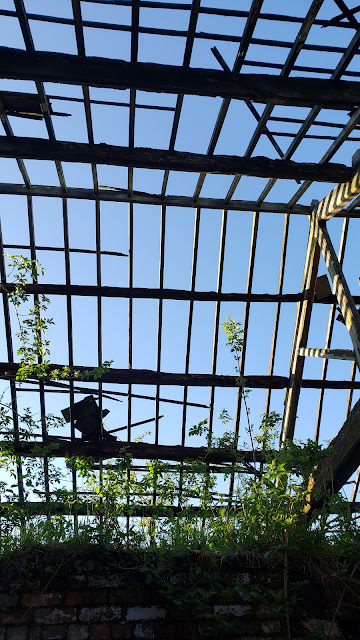 |
| Roof Without Slates at the Abandoned Property Low Moss House |
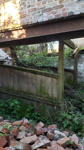 |
| Fallen Bricks at the Abandoned Property Low Moss House |
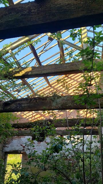 |
| Inside the Abandoned Buildings Around the Property Low Moss House |
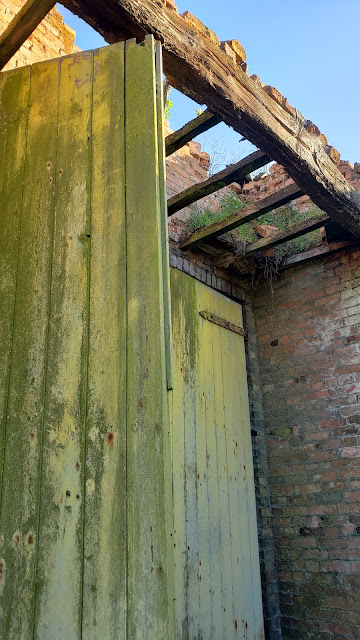 |
| Barn Doors at the Property Low Moss House |
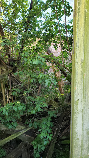 |
| Inside the Abandoned Buildings Around the Property Low Moss House |
Phew! As you can see, there were quite a few photographs. However, showing any less wouldn't really have done the explorations justice. There doesn't appear to have been any vandalism. It just appears to be a case of neglect, and nature gradually talking over. Some of the trees growing inside of the buildings seem of a reasonable age, so it must have been abandoned for some time. There is very little left in the way of any internal decoration, but you can just about see how the internal walls, floors and ceilings were constructed.
When I came to have a look for any history related to the property, I discovered a few previous explorations. I have put a link to one of them below, as it helps give an indication of how the buildings are gradually decaying. This one is from 31st May 2010.
Derelict Places: https://www.derelictplaces.co.uk/threads/abandoned-farm-in-leyland.15358/
Unfortunately, there aren't many 'like for like' comparisons, as I hadn't seen the 'Derelict Places' photographs before my visit. Otherwise, I could have taken some at identical angled to compare.
Their first picture, and my first picture give a reasonable comparison.
 |
| Derelict Places - Abandoned Farm In Leyland May 31, 2010 |
 | |
|
The History
Whilst I had spent a little of time examining the maps and satellite image before I travelled to the location, I hadn't paid too much attention to the name on the map. Going back to the old OS (Ordnance Survey) Maps, via NLoS, I could see that there was a named property in the same spot as I had been exploring. This is 'Low Moss House'. Hence, I have referred to this on my image captions. However, there is nothing to indicate whether the buildings that are currently rotting away are the once that were there in the 1840s. It's possible that something was demolished and another thing built, although, this seems unlikely.
During various web searches, I found a document published by Lancashire County Council (LCC) related to a Regulatory Committee Meeting to be held on 8 March 2023. This appears to contain notes about a Definitive Map Modification Order Investigation and an Addition of Bridleway from Nixon Lane to Willow Road along Pump House. This is roughly the area I have been exploring. I have put a link below directly to the LLC's website. There is no guarantee that it will stay available in that location, but hopefully it will.
Regulatory Committee Meeting:
https://council.lancashire.gov.uk/documents/s208709/Definitive Map Modification Order Investigation Addition of Bridleway from Nixon Lane to Willow Road.pdf
It's interesting to look at, because it includes some sections of old maps of the area that perhaps predate the OS ones. On page 10, there is an image of an old map that shows just "Low House" as opposed to "Low Moss House". Also, taking a slight deviation from the subject matter, there is a reference to 'Cockle Bar' just to the northwest of our location. That's interesting, as I know the place as 'Cocker Bar'. As is often the case, the names subtly change over the years. Either the original map maker got it wrong, or subsequently somebody else has said it or spelled it differently and eventually the name in common use changes over the time. 'Cockle Bar' or 'Cocker Bar' would have once been a Toll Bar. This would have been a place on the road where travellers would pay a toll to use the road. Various acts of parliament existed from as early as the beginning of the 17th century to govern the tolls on a county by county level, but the Turnpike Roads Act of 1773 was an Act of Parliament to explain, amend, and reduce into One Act of Parliament, the General Laws now in being for regulating the Turnpike Roads in that Part of Great Britain called England; and for other Purposes.
There is more reading on the UK Parliament's website, if you are interested.
Turnpikes and tolls: https://www.parliament.uk/about/living-heritage/transformingsociety/transportcomms/roadsrail/overview/turnpikestolls/
When looking at the old OS maps available, it can be seen that the later maps refer to the property as a farm. This isn't uncommon to see. There are dozens, if not hundreds of examples locally (and probably thousands nationally - I just haven't explored that far yet) where you can see the name of a 'House' on an earlier map become a 'Farm' on a later map. The difference can be seen between the 1840s surveys and the circa 1900 surveys. Others may know already, but I have yet to personally investigate and learn about it. I presume there was a trend for wealthy people to leave their Manor Houses and move to somewhere in the town or city. The properties left behind in the countryside were perhaps sold or leased to the farmers. They generally seem to decline, as the farmers don't necessarily have the funds to maintain the buildings to a high standard. What as once a quite well presented part of the house or overall property might end up being a cowshed or similar.
The first map is from (Lancashire) 'Sheets' published in 1848. It shows some of the area around Ulnes Walton, which includes the then 'Low Moss House'.
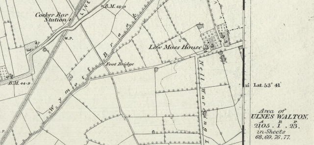 |
| 1848 OS Map Showing Low Moss House in Ulnes Walton |
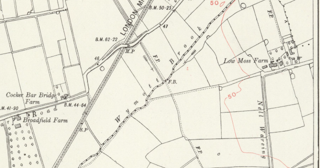 |
| Later Circa 1900 OS Map Showing Low Moss Farm in Ulnes Walton |
I found some information relative to the people who were living there from a list of 'Baptisms at St James in the Parish of Leyland' via the Lancashire OnLine Parish Clerks website. They are as follows:
Baptism: 15 Jun 1856 St James, Leyland, Lancashire, England
Elizabeth Deacon - [Child] of Joseph Deacon & Elizabeth
Abode: Low Moss Ulneswalton
Occupation: Farmer
Baptised by: R. M. Master
Register: Baptisms 1855 - 1900, Page 2, Entry 16
Baptism: 25 Jan 1857 St James, Leyland, Lancashire, England
Elizabeth Fowler - [Child] of William Fowler & Dinah
Abode: Low Moss Ulneswalton
Occupation: Farmer
Baptised by: R. M. Master
Register: Baptisms 1855 - 1900, Page 4, Entry 30
Baptism: 28 Nov 1858 St James, Leyland, Lancashire, England
Dinah Fowler - [Child] of William Fowler & Dinah
Abode: Low Moss
Occupation: Farmer
Baptised by: R. M. Master
Register: Baptisms 1855 - 1900, Page 8, Entry 59
Source: LDS Film 1526058
With regard to the map used in the LCC report that shows Low House, this appears to be a section from the 'map of the County Palatine of Lancaster from an accurate survey in the year 1828' by the mapmakers G. Hennet & James Bingley.
 |
| Low House on Lancaster County Palatine Map from 1828 |
The full map can be seen on the NLoS website: https://maps.nls.uk/view/220113211
I have embedded the current Google Map to pinpoint the area.
---------------------------------------------------------------------------
Comments
Post a Comment