The Delph in the River Ribble by Avenham Park
Over the years, I have always been slightly confused when people mention the the necessity of 'divers' when investigating things in the River Ribble by Avenham Park, adjacent to the Old Tram Road bridge. However, after being momentarily perplexed by it, my train of thought often moved onto something else. More recently, when researching the history of the Lancaster Canal, I was led to an account of divers (again) fishing something out of the River Ribble in the same location. This time, I decided to figure out why they would be needed.
The answer is that there is a significantly deep 'Delph' in the River Ribble. Strangely, whilst I thought that word was generally part of everyone's vocabulary, it turn out not to be. I didn't pop up in online dictionaries when I did a web search. Relatively locally, I have had conversations with people about 'Eccy Delph' (Eccleston Delph). It turns out that Delph comes from an Old English word (ge)delf, meaning a quarry.
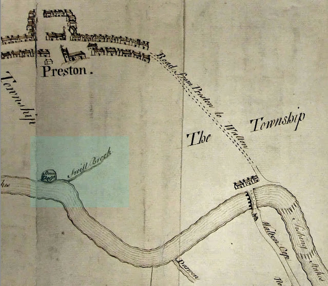
If you have a look at Old Ordnance Survey Town plans, and other maps, the feature is illustrated, but not necessarily indicated. Also, if you look at modern day satellite imagery, you can see something is there. Looking down from the Old Tram Road bridge (when you once could), I was always aware that the river bed was 'rock'. I didn't for a minute think that anybody would have ever attempted excavating it though! However, it has been there a while. It is included in a survey that Robert Porter of Goosnargh did in 1756 to create a Map of the River Ribble. This map indicates a 'Stone Delf'.
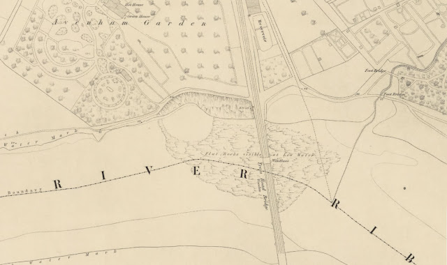 |
| River Ribble at Avenham on 1849 Ordnance Survey Town Plan |
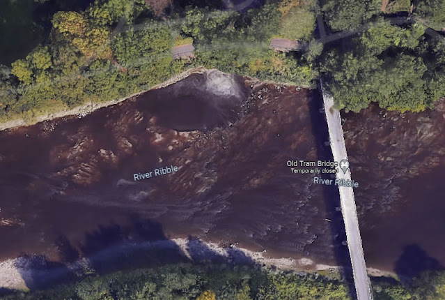 |
| River Ribble Delph at Avenham Seen on Satellite Imagery |
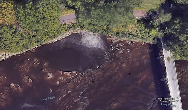 |
| River Ribble Delph at Avenham Seen on Satellite Imagery Zoomed |
What was the stone from the 'Delph' taken for? If you have a look at the Preston History website, you can see one of the 'on this day' posts reveals an answer. This is related to the Parish Church.
The church tower and steeple were taken down in 1813, and a new tower built, twenty-seven feet taller than the previous one. The tower is thought to have been built from red sandstone, quarried from the stone delph in the river, near the present tram bridge. The soft sandstone apparently proved too perishable to last long, and, in 1853, the whole building was taken down and the present church erected.
Source: https://prestonhistory.com/2023/03/22/on-this-day-23-march-1770/
That is interesting. I suppose the logistics of quarrying in that location, would have been balanced against the logistics of the transport. It is in quite close proximity, but uphill all the way. I presume it was a summertime endeavour and they created some for of dam around the location while they worked. The River is tidal to well beyond this point upstream.
Getting back to the 'diving' references. I seem to have recollections of people going missing by the river in the past, and stories about teams of divers being called in to help. The first picture reference I saw was related to a team of divers helping to recover an old tram that had once fallen of the Old Tram Road Bridge during an accident. This dive was carried out by Preston Sub Aqua Club in 1976. I have included their report about the retrieval of the tramroad wagon(s).
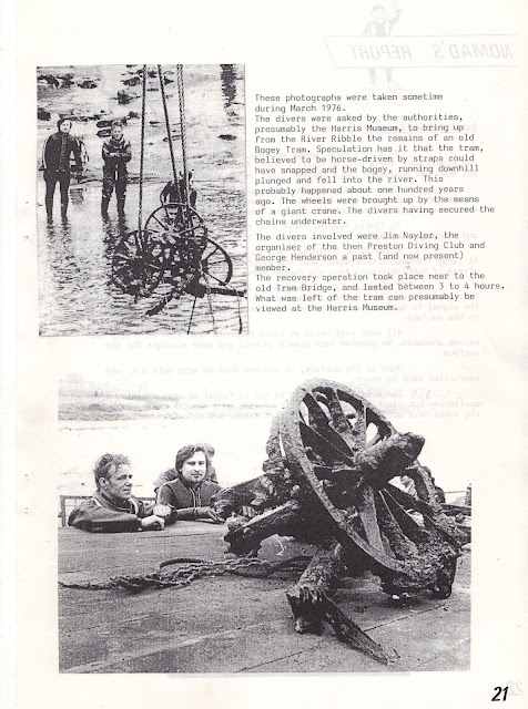 |
| Tram Road Wagon Dive by Preston Sub-Aqua Club in 1976 |
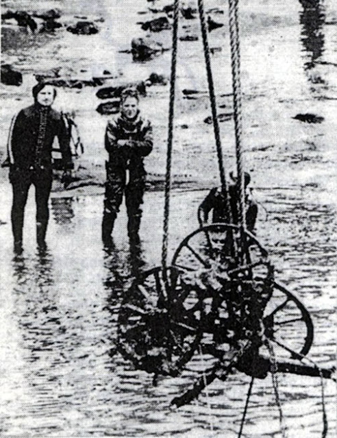 |
| Tram Road Wagon Retrieval Dive by Preston Sub-Aqua Club in 1976 |
 |
| Tram Road Wagon Retrieval Dive by Preston Sub-Aqua Club in 1976 |
These photographs were taken sometime during March 1976. The divers were asked by the authorities, presumably the Harris Museum, to bring up from the River Ribble the remains of an old Bogey Tram. Speculation has it that the tram, believed to be horse-driven by straps could have snapped and the bogey, running downhill plunged and fell into the river. This probably happened about one hundred years ago. The wheels were brought up by the means of a giant crane. The divers having secured the chains underwater. The divers involved were Jim Naylor, the organiser of the then Preston Diving Club and George Henderson a past (and now present) member. The recovery operation took place near to the old Tram Bridge, and lasted between 3 to 4 hours. What was left of the tram can presumably be viewed at the Harris Museum.
The Harris Museum or as it is more formally known, The Harris Museum, Art Gallery & Library ("The Harris"), definitely does have the tram remains. The Harris is currently closed (as of October 2021) for a major refurbishment. They are due to reopen at a yet to be disclosed time in 2025. I hope that the tram remains can be viewed again then. As far as the snapped straps go, a more likely scenario is that the chains snapped on the mechanism used to draw the trams up the very steep incline from the bridge over the River Ribble into what is now Avenham Park.
There are more details about this recovery on the Preston History website.
Industrial archaeology from the Ribble:
https://prestonhistory.com/2023/12/21/industrial-archaeology-from-the-ribble/
The second was one from the Preston Digital Archive showing a Diver in the River Ribble circa 1910. A vast crowd of spectators line both the river bank and tram bridge to witness the endeavours of a diver. It is not known if this was simply a demonstration or some sort of recovery effort.
Diver on the River Ribble: https://www.flickr.com/photos/rpsmithbarney/4423892828
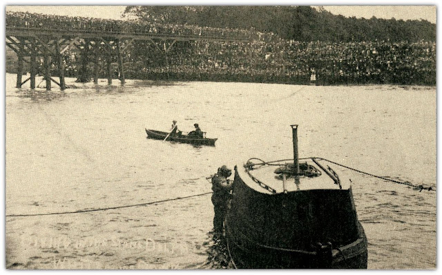 |
| Diver in the River Ribble Circa 1910 |
A vast crowd of spectators line both the River Ribble south bank and Old Tram Road bridge to witness the endeavours of a diver. It is not known if this was just a demonstration or whether some sort of recovery effort was actually taking place. It has been proposed that it may be related to the accompanying article on the Preston Digital Archive Flickr gallery.
Extract from the Lancashire Daily Post 24th June 1907.
PRESTON BATHING FATALITY.
DIVER'S FRUITLESS SEARCH FOR THE BODY.
Thousands of people assembled in the vicinity of the Old Tram Bridge, Preston, on Saturday to witness an effort to recover the body of John Clayton, a seven-year-old boy, who was drowned whilst bathing in the Ribble on Tuesday week. The boy was seen to disappear at a point immediately below the bridge, close to the Preston side of the river, and familiarly known as the Whirlpool or the Delph. There have been many wild conjectures as to the depth of this place, some asserting that it had never been fathomed. It was generally believed the body bad disappeared in the mysterious cavity, but long and continued dragging operations failed to secure it.
In the hope of removing an doubt, Councillor Worden (Trinity) interested himself in the matter, and secured the services of the Corporation diver, who came up with the Corporation, boat and apparatus on the afternoon's tide. He made five descents into what is understood to be an old quarry. On each occasion he was under water for about 20 minutes, and made a most minute search, but finally had to inform the bereaved father that he was perfectly satisfied the body of his son was not there.
The diver attained varying depths, the greatest, however, being estimated at 20ft. He found a number of wagon which are believed to be the remains of some trucks used on the old tram road, and which some 40 or 50 years ago were thrown into the river through the breaking of the winding rope by which they were then drawn from the bridge up a steep slope on to the level.
It is said that the delph could have been as much as 25 feet deep. However, also that it had been filled in to some extent in the past. Either way, I can now understand the danger, and why that area of Avenham Park is fenced off these days.
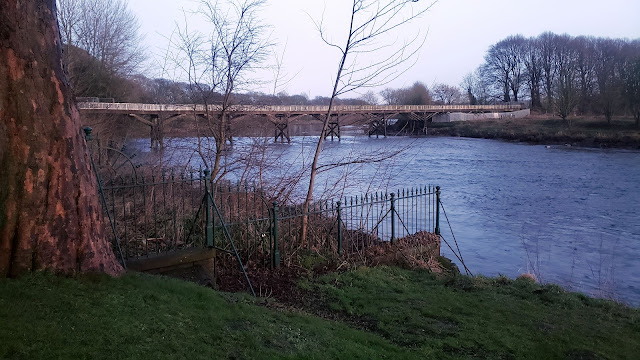 |
| View of the River Ribble and the Old Tram Road Bridge |
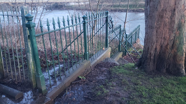 |
| View of the River Ribble and the Avenham Park Safety Fence |
Preston Minster, formally the Minster Church of St John the Evangelist, is in Church Street, in the centre of Preston, Lancashire. From its origin it has been the parish church of Preston.
 |
| Preston Minster - From its origin it has been the Parish Church of Preston |
Another excellent reference for anything related to the Lancaster Canal, to which the Old Tram Road belonged, is the Restoring Preston Basin website. A picture of the tram wagon parts at The Harris can be seen there.
Restoring Preston Basin: https://www.prestonbasin.org/
---------------------------------------------------------------------------
My accounts of the local area - About this Blog
Comments
Post a Comment