The Remains of
Preston's Third Town Hall
A journey to Howick Cross
In January 2023, on a pleasant but very cold day, I went for a walk along the Ribble Way on the section from Penwortham Holme towards the western end of the route that ultimately ends at the Dolphin Inn pub in the marshes of Longton village.
The river has a lot of reinforcement around that area, I presume to help prevent erosion. This includes rubble that I think came from the old Penwortham Power Station and a section of more formal gabions (wire mesh crates with rubble inside them stack upon each other like bricks) to protect the feet of the electricity pylons that take the high tension cable across the River Ribble. The remains mainly consist of reinforced concrete sections and red brick as you first leave Holme Road toward the marshes. This led me to speculate that it was from a relatively modern structure.
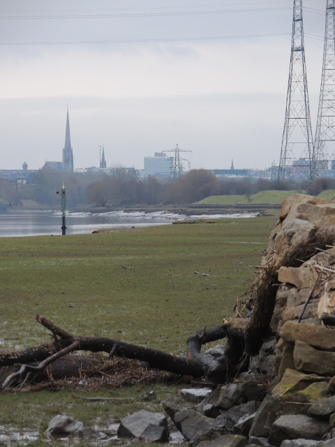 |
| A View of Preston from Howick Cross |
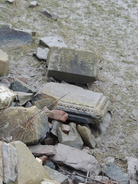
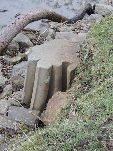
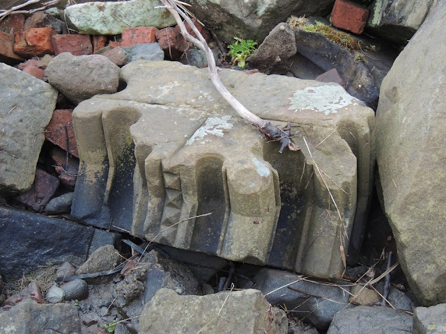
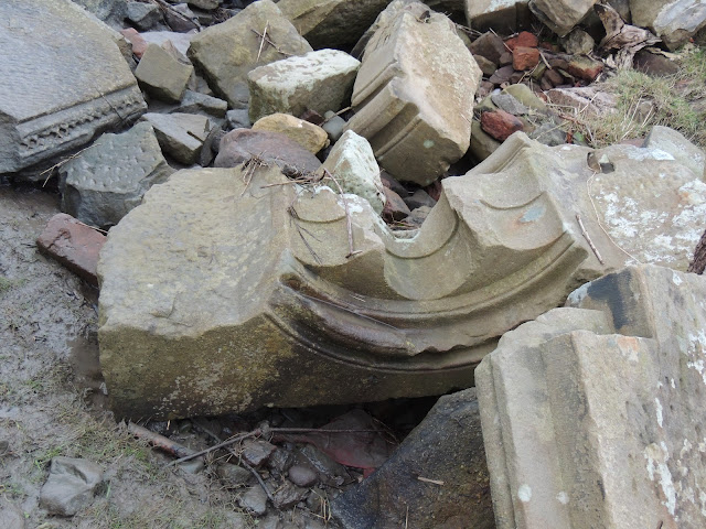
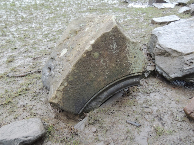
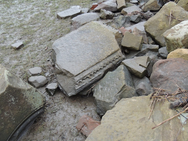
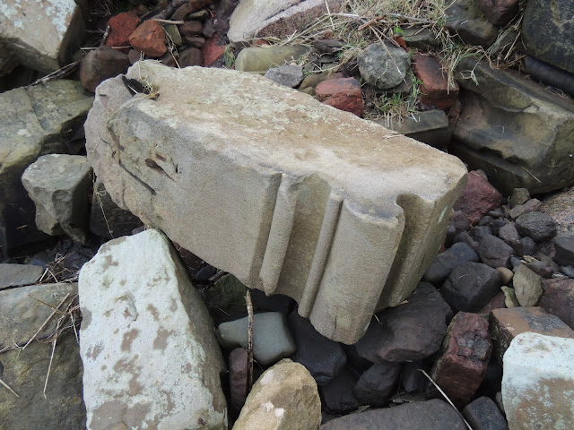
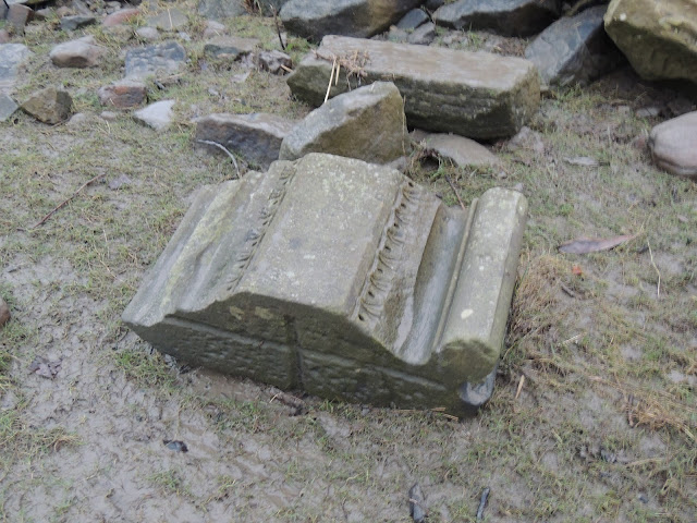
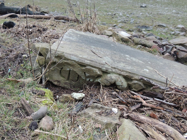
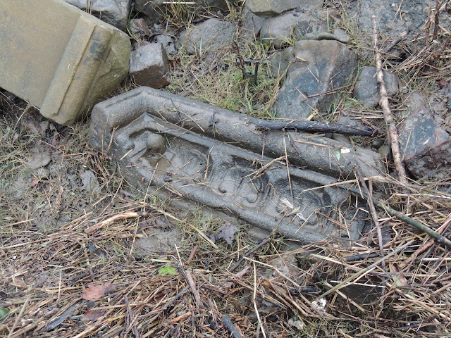
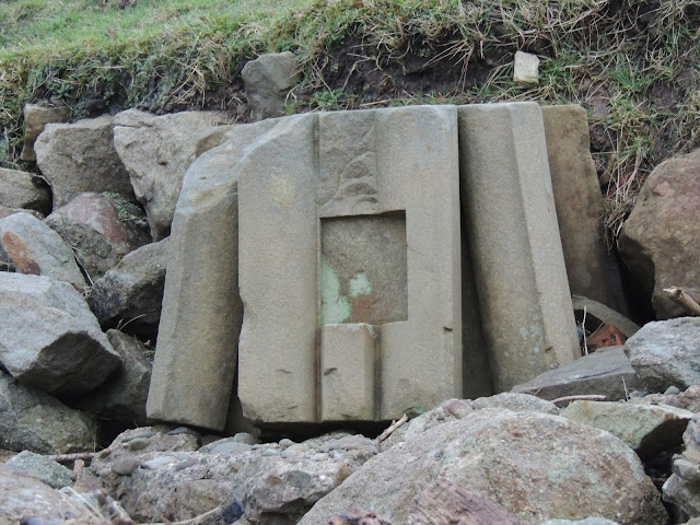
However, when I reach the point where Mill Brook flows into the River Ribble the nature of the rubble changed. This particular stonework seemed odd, much of it was dressed. Many pieces had elaborate carvings, were quite large and you could see that they were quite often smaller sections that would have formed features, such as arches. It seemed strange, and I wasn't aware of any grand buildings that would have been in that area, which I think would be classed as Howick Cross.
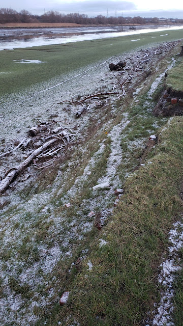 |
| Dressed Stonework by the River Ribble at Howick Cross |
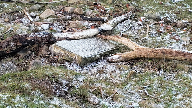 |
| Dressed Stonework by the River Ribble at Howick Cross |
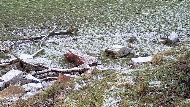 |
| Dressed Stonework by the River Ribble at Howick Cross |
When I got home, I consulted the old maps. Indeed there hadn't been anything recorded there since 1848 onwards. At the time, I couldn't think of anybody to ask, so couldn't identify which building it had come from. It was fancy though. It might have even been a church.
In December 2023, a member of the Preston Past and Present Facebook group posted some pictures with the description, "Preston Town Hall 1862-1947 R.I.P. built by George Gilbert Scott, apparently the rubble that was taken away, after its mysterious fire, is dumped on the river bank, down at the bottom of Howick Cross Lane."
Ah, I see. Now it all makes sense. What a terrible shame. Many of the pieces still seem in pretty good condition considering they have been battered by the river flow, debris and tides for maybe three quarters of a century. It seems a pity that there weren't reclaimed and used for something else, at worse, or better still, the building had been saved.
 |
| Dressed Stonework by the River Ribble at Howick Cross |
 |
| Dressed Stonework by the River Ribble at Howick Cross |
 |
| Dressed Stonework by the River Ribble at Howick Cross |
 |
| Dressed Stonework by the River Ribble at Howick Cross |
 |
| Dressed Stonework by the River Ribble at Howick Cross |
 |
| Dressed Stonework by the River Ribble at Howick Cross |
 |
| Dressed Stonework by the River Ribble at Howick Cross |
 |
| Dressed Stonework by the River Ribble at Howick Cross |
 |
| Dressed Stonework by the River Ribble at Howick Cross |
 |
| Dressed Stonework by the River Ribble at Howick Cross |
 |
| Dressed Stonework by the River Ribble at Howick Cross |
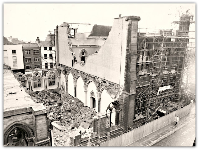
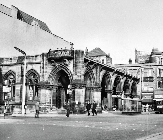
The Town Hall that was once on Fishergate had been reduced to a smouldering ruin on Saturday 15th March 1947. Fire had raged for three hours from 3am and had swept through the entire building. The old Guild Hall had been completely gutted and the cherished clock tower had crashed 180 feet into Fishergate. Tons of debris from the clock tower tumbled down into Fishergate narrowly missing the shops on the other side of the road. The day after the fire workmen began demolishing the remains of the clock tower and the building was patched up to allow partial use of the ground floor. The north section of the building also remained.
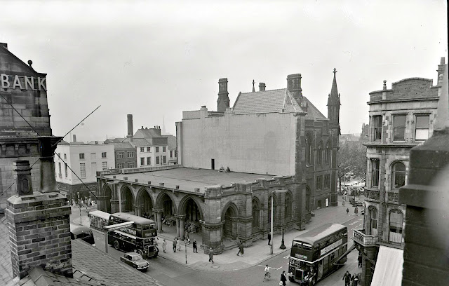 |
| Preston Town Hall - Ground Floor and North Section Remains After the Fire |
 |
| Preston Town Hall - Ground Floor and North Section Remains After the Fire |
 |
| Preston Town Hall - Ground Floor and North Section Remains After the Fire |
Initially, the intention was for the building to be rebuilt and restored to its former glory. However, as time dragged on, the interest in the idea cooled and eventually the town council decided to knock it down and lease the prime site to the highest bidder. In 1962 demolition gangs moved in and the final destruction of Preston Town Hall was completed.
The Town Hall in Its Heyday
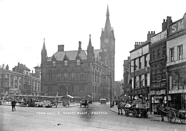 |
| Sir George Gilbert Scott's Preston Town Hall, Market Square, Preston |
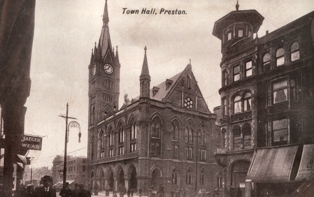 |
| Town Hall Preston Looking Towards Fishergate From Church Street |
This building was actually Preston's third town hall and we are now on our forth. I wonder who long that will last.
I have included a link to a post on the Lancashire Evening Post website below. This includes a good article about the fire, some pictures of the blaze and the bells.
My apologies for all the annoying adverts etc.
https://www.lep.co.uk/news/night-flames-tore-through-citys-finest-landmark-733303
The Location
If you're interested in visiting the ruins by the River Ribble, you can follow the Ribble Way from Holme Road. The coordinates are as follows
53.753436, -2.774028
349059,428841
There is also a what3words address that refers to a 3 metre square location next to the ruins.
Tap the link or enter the 3 words into the free what3words app to find it.
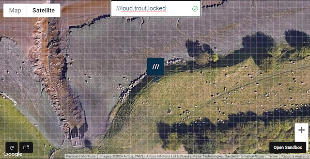 |
| what3words: ///loud.trout.locked |
what3words: ///loud.trout.locked
https://w3w.co/loud.trout.locked///loud.trout.locked
Further reading:
Sir George Gilbert Scott
After nine years of trying to decide if it could afford a new town hall, Preston Council decided that ‘an eminent architect’ would have the necessary authority to bring the scheme to fruition. By February 1862 the Council had chosen a site and Scott was requested to submit plans, a drawing of the ‘Market’ exhibited by Sir George Gilbert Scott at the Royal Academy that year.https://gilbertscott.org/preston-town-hall-market-square-preston/
---------------------------------------------------------------------------
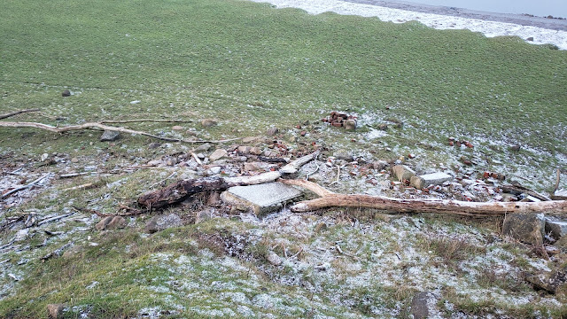
I revisited the site today, and realised that my previous map location was slightly off, and I had it marked too far to the East. My previously identified location had the spot at the east bank of Mill Brook. That rubble is mainly concrete. The Town Hall ruins are about 200 metres (approximately 200 yards) further west. The correct What 3 Words location is ///foam.limp.forms
ReplyDeleteWhat 3 Words location link: https://w3w.co/foam.limp.forms